Enhanced Version of the EPA’s EJScreen Tool Now Available
In accordance with the EPA’s responsibilities to protect human health and the environment, the Office of Underground Storage Tanks has been working with the EPA regions, states, and Tribes to integrate environmental justice (EJ) into the national tanks program. The EPA appreciates the work that programs are doing across the country to advance EJ and to address cumulative burdens that communities face. Some states have developed their own mapping tools and databases to help clarify program priorities, identify focus areas, and advance state and federal program objectives.
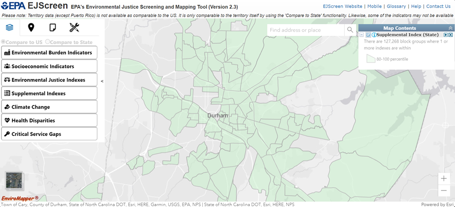
The data that states and Tribes provide helps develop comprehensive national applications such as EJScreen and UST Finder that can assist in meeting program and EJ goals. EJScreen, the EPA’s EJ mapping and screening tool, aids efforts to ensure programs, policies, and resources consider the needs of communities most burdened by pollution.
EJScreen 2.3 features 13 environmental indicators. The environmental indicators vary widely in what they indicate, and it is important to understand the caveats and limitations. For example, some quantify proximity to potential sources of exposure to environmental pollutants, while others are estimates of ambient levels of air pollutants.
EJ indexes combine a single environmental indicator with socioeconomic information. EJScreen 2.3 features two types of EJ indexes: standard and supplemental. Each has a different calculation of socioeconomic data. There are 13 standard EJ indexes and 13 supplemental EJ indexes reflecting the 13 environmental indicators.
Read more information about environmental indicators and indexes in theEJScreen Technical Documentation.
The EPA recently updated EJScreen to version 2.3, which includes several enhancements to the application. UST Finder is a state-sourced mapping application that provides the attributes and locations of active and closed USTs, UST facilities, and UST releases in a Geographic Information System platform. The platform also includes layers of other environmental and socioeconomic data, providing a detailed snapshot of communities that have USTs. Both tools are available online and have updates underway.
EJScreen provides a nationally consistent dataset and approach for combining environmental and socioeconomic indicators. The application is a useful tool that screens for disproportionate impacts on communities. This can support tanks programs in their efforts to integrate EJ considerations and address cumulative burdens across the country. For example, some states use EJScreen criteria to identify sites in areas with one or more EJ indexes at the 80th percentile to prioritize cleanup decisions and actions. Where all site risks are equal, EJ criteria are prioritized.
EJScreen includes an Underground Storage Tank environmental indicator derived from UST Finder data. The UST indicator is calculated as a weighted sum of active UST releases and active and temporarily out-of-service USTs within a certain distance from a block group. Like all environmental indicators in EJScreen, the UST indicator can be combined with socioeconomic information to create corresponding standard and supplemental indexes.
Just as EJScreen uses UST data, the UST Finder application also features EJScreen data. The EJScreen data in UST Finder allows users to screen for disproportionate impacts on communities directly within the tool. The EPA expects to update UST Finder with EJScreen 2.3 data in the process of updating UST Finder to version 2.0.
As of July 2024, EJScreen version 2.3 features several enhancements, updated datasets, and new map layers, including:
- Interface changes.
- New environmental indicators: nitrogen dioxide and drinking water non-compliance.
- New map layers: extreme heat, private drinking wells, drinking water area boundaries, air toxics cancer risk, and environmental justice grants.
- Methodological changes.
- The supplemental index was reformulated to include disabilities data and exclude unemployment data.
You can check out all the newly added EJScreen 2.3 features and data in the EJScreen Change Log.
The EPA provides trainings and office hours to help guide users through EJScreen and become familiar with the updates. Office hours provide an opportunity to talk with the EPA EJScreen experts about many topics including how to use and apply the tool.
Author
Issue: #94 | View Archives
Connect With Us
Sign up for our monthly
e-newsletter