Scientists, teachers, and local communities along the Hudson and Mohawk Rivers in New York can now quickly access water quality and weather data in real time through a newly redesigned website, the Hudson River Environmental Conditions Observing System (HRECOS). The site features an updated user-friendly dashboard, which tracks conditions and transmits information back from 17 monitoring stations along the waterways. The resource also provides helpful explanations for site visitors to understand the data.
“Not only does the updated website bring a more modern and welcoming experience for site visitors, but the data is also easier to access,” said Brittney Flaten, NEIWPCC environmental analyst and HRECOS coordinator. “The new educational dashboard feature is a great resource for those looking for more context and fun facts around the data and monitoring location.”
Each monitoring station is equipped with sensors that measure water quality parameters, such as dissolved oxygen and pH, and/or weather conditions every 15 minutes, with most stations operating year-round. The real-time data page under the “Track Conditions” tab allows users to select a monitoring station(s) and search by parameter(s) and date range. Each search results in a graph, allowing users to compare the data to the previous year’s results for that selection, or download the data for further analysis.
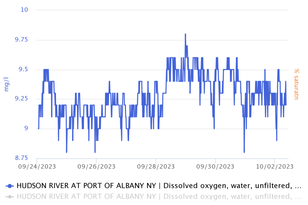
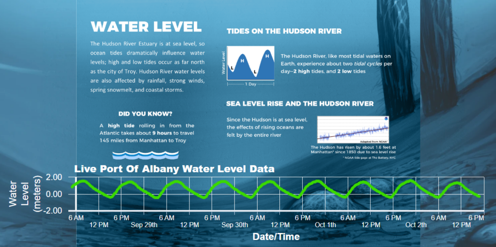
The new “Explore” tab uses current data in an educational dashboard aimed at a broader audience. It provides an overview of the seven featured monitoring stations, each operated by a different HRECOS partner, as well as an explanation of the selected parameter: water level, water temperature, dissolved oxygen, turbidity, conductivity, acidity and salinity.
Putting the Data to Use
Under the “Interpret Data” tab, the site now provides resources for educators and researchers in a central location. Educators will find downloadable lesson plans and other tools for elementary and high school grade levels. The materials utilize the HRECOS data and aim to connect students to the estuary while aligning with Next Generation Science Standards.
Scientists and researchers can access long-term data – the Tivoli Bays monitoring station has been active since 1995, for example – to inform hypothesis testing, models, statistics and more. This section also includes a searchable library of research publications of the Hudson River.
About the Hudson River Environmental Conditions Observing System (HRECOS)
Established in 2008, HRECOS is an environmental monitoring network that is managed and operated through a collaboration of governmental, academic, and private institutions, including NEIWPCC, the New York State Department of Environmental Conservation, the United States Geological Survey and others. The network provides geographically distributed, high frequency, real-time data for the Hudson River Estuary to help understand, manage, and protect the river for future generations.