The landscape along Rhode Island’s south coast is carved up by salt ponds, each one a unique environment. A new, online resource tells the story of these ponds and the organization that protects them.
The Narragansett Bay Estuary Program partnered with the Salt Pond Coalition to create a StoryMap—an interactive, online medium that integrates detailed maps with other visuals and text to communicate science in an engaging way.
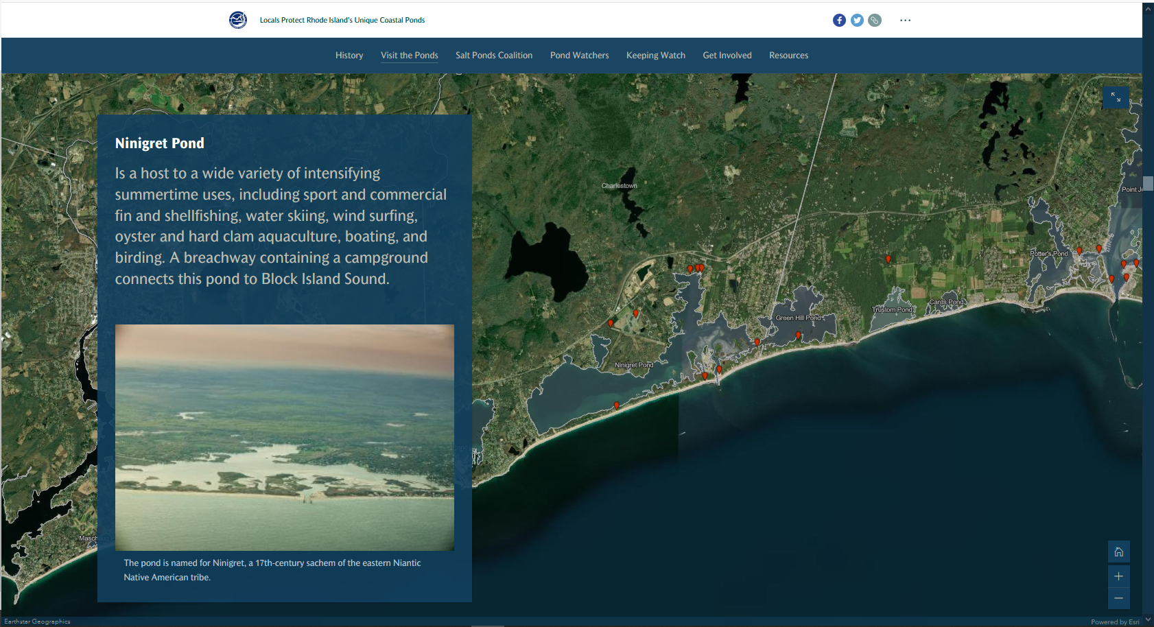
Users of this StoryMap can click on different locations along Rhode Island’s south coast to learn about each pond. Formed by glacial deposits thousands of years ago, the ponds are each influenced by their unique interactions with salt and fresh water.
The Salt Pond Coalition’s mission is to protect these water bodies, some of which have seen heavy species and habitat loss over the last few decades and vary in their degree of pollution.
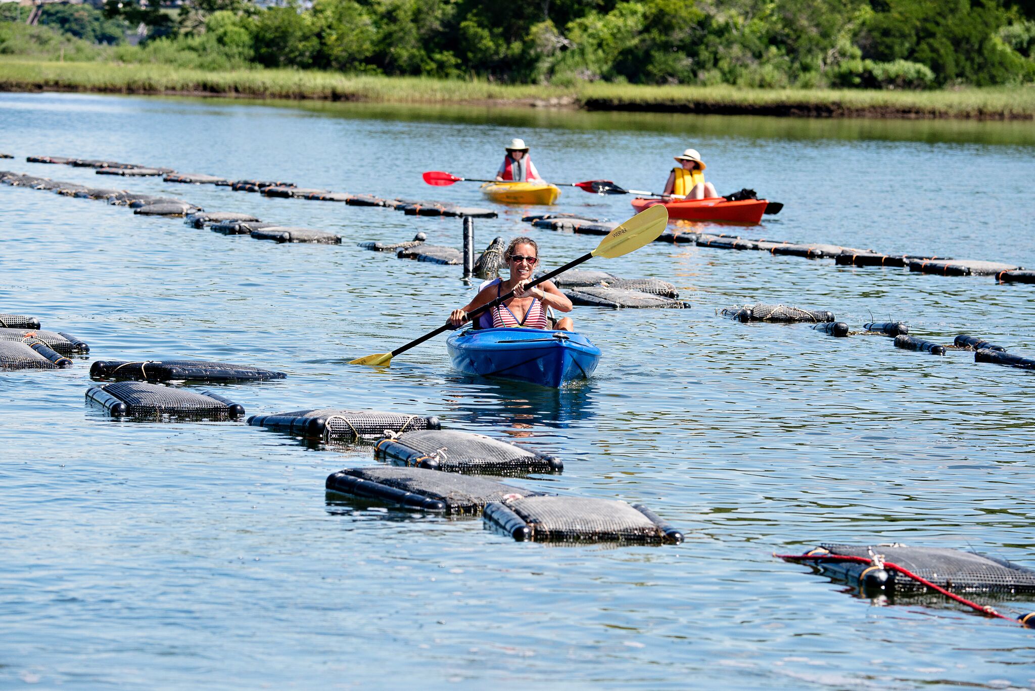
The ponds are valuable economic resources for the state and its densely populated coastline. Some are important to the oyster farming industry; many are popular recreational destinations.
The StoryMap describes the Salt Pond Coalition’s “Pond Watchers” program—the oldest volunteer marine water sampling program in the country—and encourages community members to get involved. The program helps monitor bacteria levels, which can fluctuate from day-to-day, and year-to-year, in many of these water bodies.
Partnering for a More Comprehensive Plan
Julia Bancroft, an environmental analyst for the Narragansett Bay Estuary Program, worked with Alicia Schaffner, executive director of the Salt Pond Coalition, and other coalition members to create the StoryMap.
The Narragansett Bay Estuary Program, which is a program partner of NEIWPCC, recently started the process of updating their comprehensive conservation and management plan. As part of updating this “Vision 2032” plan, Bancroft said the estuary program has begun reaching out to other environmental organizations and stakeholders to strengthen partnerships and include them in the planning process.
“When we did our 2017 State of the Narragansett Bay report, we didn’t include data for some of the smaller watersheds in our region,” Bancroft said. “The idea of doing this StoryMap was inspired by the fact that we have these two other study areas—Little Narragansett Bay and the Southwest Coastal Ponds—that we need to include in our management plan. It was important for us to collaborate with the Salt Pond Coalition, which is really the major environmental group in that area.”
Bancroft said many Rhode Islanders don’t realize how many coastal ponds there are, and that she hopes the StoryMap helps the Salt Pond Coalition recruit new volunteers and educate more community members.
Additional Maps Highlight Coastal Usage, Environmental Justice
This StoryMap, “Locals Protect Rhode Island’s Unique Coastal Ponds,” is just one of several the Narragansett Bay Estuary Program has created recently.

Julia Twichell, watershed and geographic information systems (GIS) specialist for the estuary program, completed the award-winning StoryMap “How Do We Use Our Coasts?” This resource ties anonymized location records from mobile devices to public coastal access sites in Rhode Island. The map received the Best Interagency Collaboration award from the 2021 Esri Federal GIS Conference Map Gallery. Twichell worked with staff from the EPA Office of Research and Development’s Atlantic Coastal Environmental Sciences Division.
More recently, Twichell completed “Environmental Justice in the Narragansett Bay Region.” This project links various demographic and environmental factors from the EPA’s Environmental Justice Screening and Mapping Tool to highlight inequities in the watershed.