
Researchers, educators, anglers, paddlers and local communities along the Hudson and Mohawk Rivers in New York can now access high-frequency water quality and weather data through a newly redesigned Hudson River Environmental Conditions Observing System (HRECOS) website. The site aims to make the live and historical data from 15 monitoring stations along the waterways more accessible, interactive and functional.
Each monitoring station is equipped with sensors that measure water quality parameters every 15 minutes. Some locations also collect data on weather conditions such as wind speed and direction, relative humidity, and air temperature, and many stations operate year-round. To view current water quality conditions, site users select a station and parameter: water temperature, dissolved oxygen, turbidity, specific conductance or acidity. Each parameter offers an explanation and helpful context for users to understand the data, such as that fish need water with at least 5 mg/L of dissolved oxygen to survive.
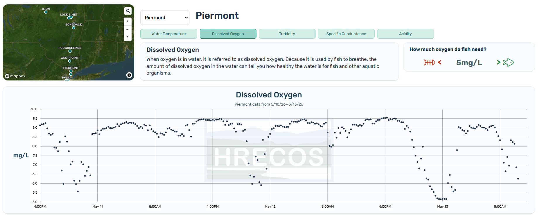
Another update is that the data is now managed by New York State Mesonet, no longer by the United States Geological Survey (USGS). Despite this back-end change, all historic and long-term information is still available through a new data request portal on the revamped HRECOS website. Here, users can select data for specific stations, dates, and variables to be emailed to them.
The website also provides resources for educators such as lesson plans and hands-on tools aimed at connecting students to the estuary. A page for researchers houses a searchable library of published studies.
Additional website updates are underway to further enhance interactive elements of the dashboard.
About the Hudson River Environmental Conditions Observing System (HRECOS)
HRECOS has collected data since 2008. The environmental monitoring network is managed and operated through a collaboration of governmental, academic, and private institutions, including NEIWPCC, the New York State Department of Environmental Conservation, and several others. The network provides geographically distributed, high frequency, real-time data for the Hudson River Estuary to help understand, manage, and protect the river for future generations.