
Since 2006, staff at the New York State Department of Environmental Conservation’s (NYSDEC) Hudson River National Estuarine Research Reserve (HRNERR) have worked to eradicate the invasive wetland plant, phragmites (Phragmites australis). Also known as common reed, phragmites quickly overtakes wetland areas, degrading the ecosystem. Over the years, the management approach has evolved alongside changes in available technology, plant distribution, and understanding of best practices. In the spring of 2026, a new approach took flight: the use of a drone to map the phragmites population in the Hudson River’s Tivoli North Bay.
The Research Reserve – a NEIWPCC program partner – is a partnership between the NYSDEC and the National Oceanic and Atmospheric Administration. It consists of four tidal wetland sites along the estuary where staff conduct integrated monitoring, restoration, education, and research programs, such as invasive species management.
“The priorities of phragmites control have changed over time,” said NEIWPCC Environmental Analyst and Hudson River Estuary Program Habitat Restoration Coordinator, Dan Miller. “We’ve come up with different management strategies—not only methods for controlling and mapping it, but also for understanding the circumstances where we have our best chance of having a positive effect.”
Phragmites is a perennial grass that can grow as tall as 14 feet by late summer with feathery, tufted seed heads. It invades wetland areas, outcompeting native species such as cattail, and forming dense, thick stands. Beginning in the 1960s, phragmites began spreading rapidly in Hudson River marshes, altering the habitat and hydrology, and decreasing biodiversity.
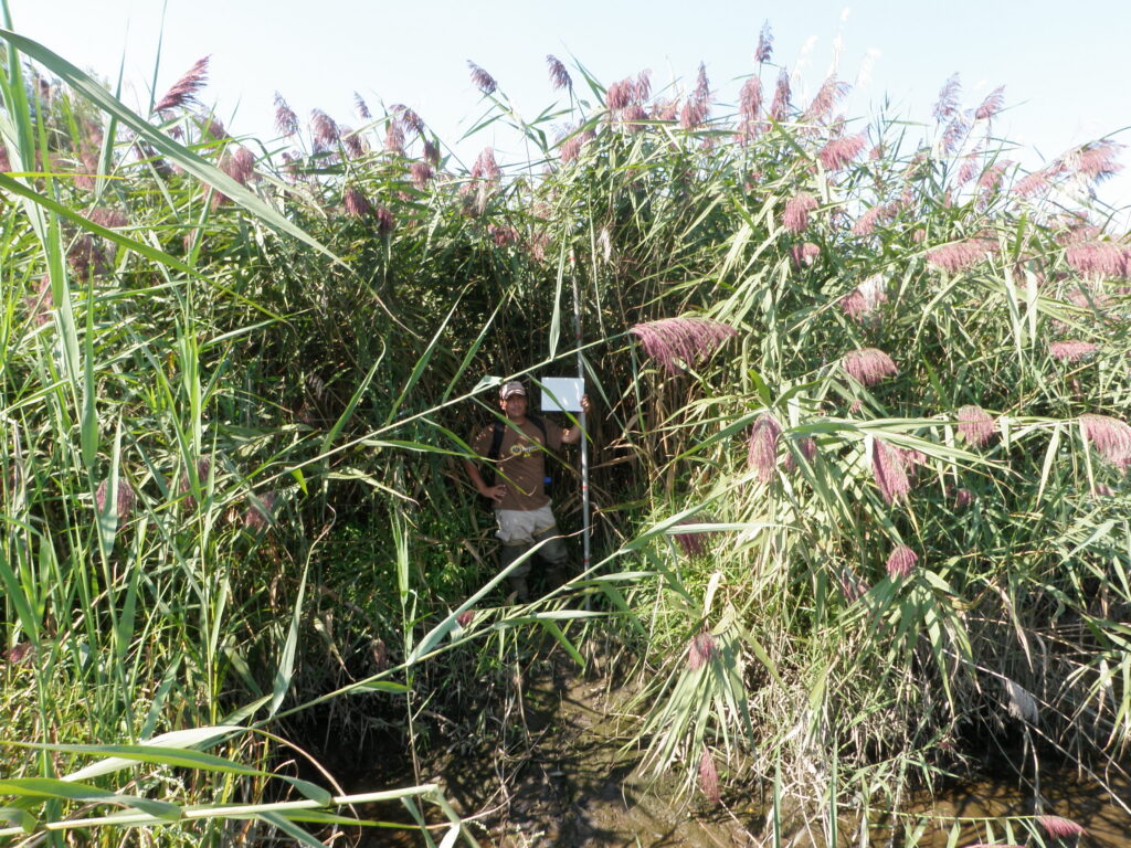
At the Tivoli Bays Research Reserve site – located in the town of Red Hook – the focus has shifted to maintaining the gains of several years of phragmites management efforts. Each spring, HRNERR staff conduct encounter surveys by walking the marsh and recording the GPS location of the plants. However, with the site covering more than 350 acres, Miller acknowledges that there were portions of the marsh that were inaccessible and went unsurveyed.
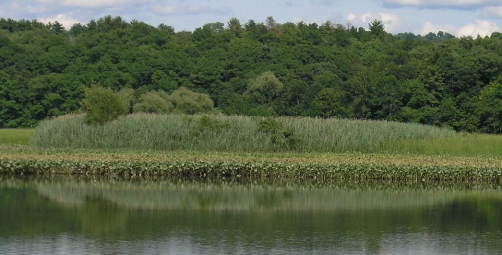
“We’d go out in the spring, around April, and walk on the marsh,” said Miller. “Phragmites generally remain standing over the winter making it easy to identify, while the cattail lays down. So, you can stand on the marsh, see where the phragmites is, then go and map it.”
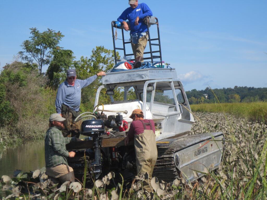
Back at his desk, Miller used the GPS coordinates collected in the field to create a map of phragmites presence. Partnering with Brian DeGasperis, HRNERR stewardship coordinator, they used the map to guide treatment, including herbicide applied by a licensed pesticide applicator. Remote areas of the marsh were accessed by an amphibious vehicle called a Marsh Master. Miller notes a downside to this approach: The large piece of machinery inevitably caused physical impacts on the marsh.
“We’ve had over 95% initial reduction in phragmites in treated areas,” said Miller. “Now we are trying to control it with alternative methods, including physical cutting and covering – a labor-intensive approach. So, it’s really important that we find it early and that we find it all, so this method can be effective.”
Miller worked with Leslie Garret, a contractor who had previously completed graduate research on plant communities at the Reserve by using drones to identify species. Mapping plants using multispectral and/or RGB imagery via drone is a method often used in agriculture to assess identification, health and biomass. Different plants reflect different wavelengths of light including some not in the visible spectrum, and the mapping software can look for specific wavelengths and assign it to specific species, such as phragmites. The resulting maps provide high-resolution, precise GPS location of the target species, make mapping efforts easier and more accurate. From this partnership, the concept of identifying phragmites using unmanned aerial survey was born.
In 2026, Garret flew a drone in Tivoli North Bay to determine if the resulting maps would be accurate and detailed enough to direct phragmites control measures in the future. He mapped the reed in the spring, finding that the plants were hard to distinguish from other species, and again in the fall, when it is easier to identify the tall, dark plants.
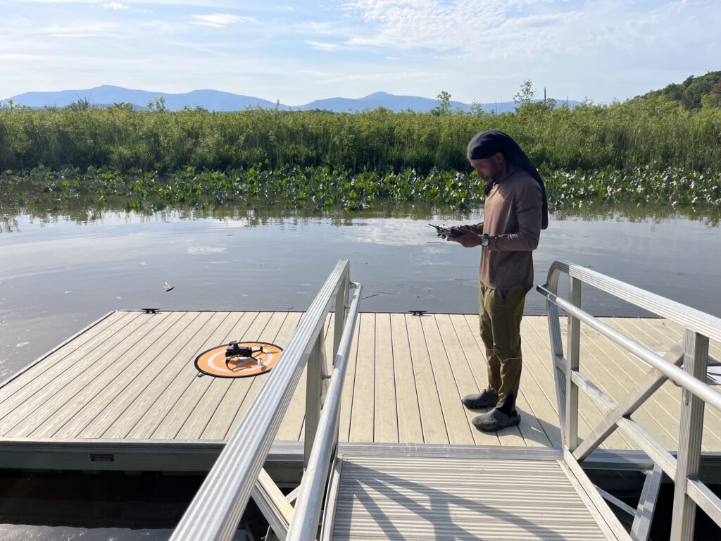
During this evaluation, Garret used a three-factor system for identifying phragmites including specific reflectivity, seed head shape, and canopy height. The resulting maps identified most areas where phragmites is known to exist, but Miller notes it may have missed some less mature areas where the plants are not as tall.
“The imagery is very helpful – we can identify mature phragmites by eye from the photos,” said Miller. “The resulting maps give us a more complete inventory of where phragmites is in the marsh. Now, we can get a much better look at the more remote areas to find larger stands of plants.”
Miller and DeGasperis continue to evaluate the maps’ accuracy in identifying smaller, less mature plants to improve targeted management efforts and reduce marsh disturbance.
Learn more about invasive species.