
The Hudson River National Estuarine Research Reserve (HRNERR), a NEIWPCC program partner, joined the Webcam Coastal Observation System (WebCOOS) network by installing a webcam at the Norrie Point Environmental Center in Staatsburg, New York. This effort is in partnership with the national Integrated Ocean Observing System (IOOS) and their regional branch, the Mid-Atlantic Regional Association Coastal Ocean Observing System (MARACOOS), the Hudson River Pilots, and the New York State Department of Environmental Conservation (NYSDEC). HRNERR consists of four tidal wetland sites and is operated as a partnership between the NYSDEC and the National Oceanic and Atmospheric Administration.
The camera takes a snapshot of river conditions every 30 minutes, 24 hours a day, providing visual data for coastal management and river navigation. WebCOOS data are used by environmental managers, public safety and health officials, and weather forecasters in a variety of ways. For example, the images and videos can provide coastal information on beach erosion, flooding, rip current detection, and beach and river usage to ultimately inform decision-making.
The Hudson River webcam is the only estuarine camera of the four in New York. Located 84 miles upstream from the mouth of the Hudson River, the camera was originally installed for river pilots who guide vessels to the ports along the river, with Norrie Point as a halfway station.
“The camera feed was allowing the river pilots to look at fog conditions, weather conditions, tide conditions—anything helpful for their ships traversing the river,” said NEIWPCC Environmental Analyst Chris Mitchell. “So, we already had this camera with limited capabilities in place. Then we connected with MARACOOS to upgrade our equipment. It sounded like a great test site for the future since in the long run we want to install more of these cameras at existing environmental monitoring station operated by HRNERR.”
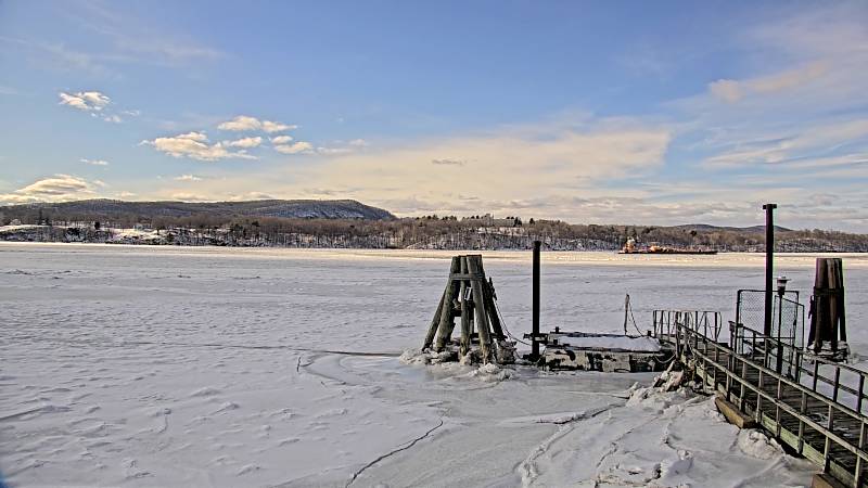
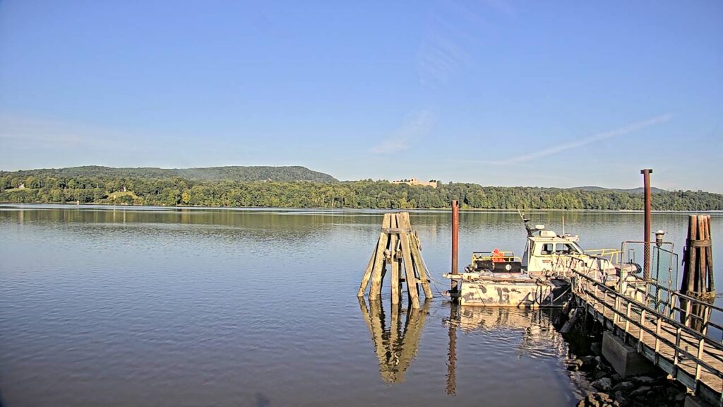
View from the webcam at the Norrie Point Environmental Center on February 12, showing a frozen river, and on September 8, with the docked river pilot boat. Click image to enlarge.
“We formed a partnership where the [river] pilots pay for the camera, MARACOOS hosts the data, and the Reserve does the maintenance on it,” said Mitchell, who has served as the Hudson River National Estuarine Research Reserve research coordinator since 2010.
The webcam debuted on the WebCOOS network webpage in February 2026, allowing this data to be publicly available for the first time.
Additionally, the information can be accessed as a data layer on the MARACOOS OceansMap dashboard, which is a source of high-quality ocean and coastal data that undergoes IOOS certification and quality checks. This dynamic, customizable platform combines near-real-time observations and model forecasts from the region.
The dashboard’s robust offering of more than 100 data layers include wave, wind, currents, salinity, water temperature and level, biogeochemical, harmful algal bloom and atmospheric predictions. It also integrates data from the National Estuarine Research Reserve System and 17 monitoring sites along the Hudson and Mohawk Rivers as part of the Hudson River Environmental Conditions Observing System (HRECOS).
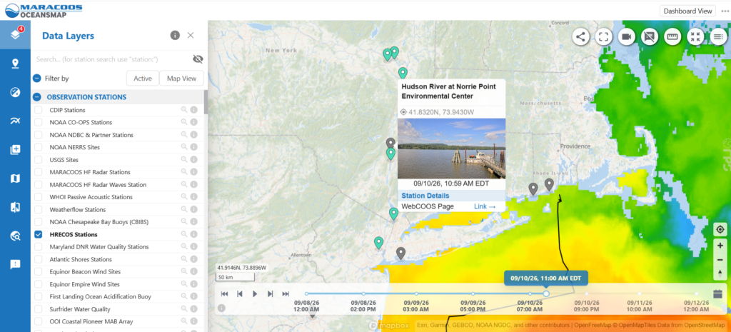
Mitchell described possible applications of the WebCOOS data to estimate visibility, water level, flood inundation and to monitor algal blooms. He is hopeful to add more webcams to the Research Reserve’s tidal monitoring stations in Turkey Point, near Glasco, and Coxsackie. These stations record real-time water temperature and level, conductivity and meteorological conditions.
“My dream is to expand the WebCOOS network to incorporate all of our environmental monitoring stations to get that visual component that has been historically absent from our dataset,” said Mitchell. “A camera system would expand the repertoire that we already have and add to the story that numerical monitoring data may already be telling.”